

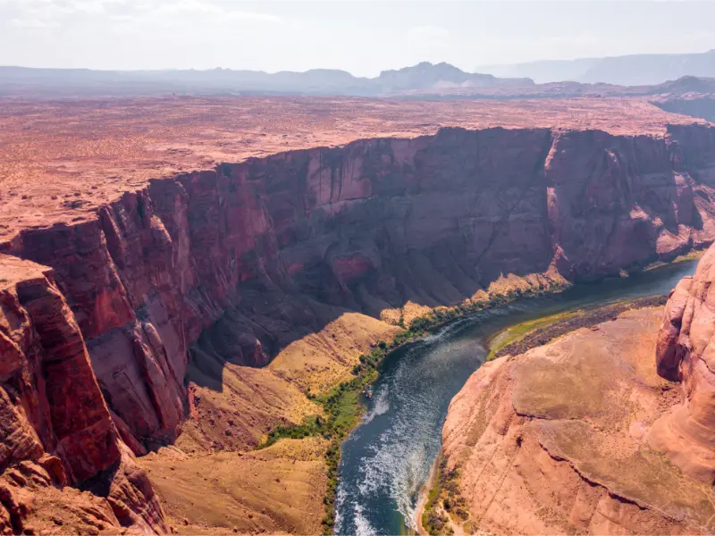
Horseshoe Bend is easy to underestimate because the logistics are simple: drive south of Page, pay for parking, walk roughly 0.6 mile to the rim and look down at the Colorado River. The simplicity is exactly why the site becomes crowded and why heat, exposed edges and sunset parking deserve more planning than the mileage suggests. A good visit takes about 60–90 minutes, longer if you want to photograph changing light.
| Parking 2026 | $10 passenger vehicle; $5 motorcycle |
| Hours | Parking entry sunrise to sunset |
| Walk | About 0.6 mile each way |
| Reservation | Not required for self-guided visit |
| National park pass | Does not cover City of Page parking |
Current 2026 parking and hours
The City of Page parking area charges $10 for a standard passenger vehicle or RV and $5 for a motorcycle. Commercial vehicles pay higher rates based on capacity. The lot accepts arriving vehicles from sunrise to sunset. The overlook lies within Glen Canyon National Recreation Area, but the parking lot is city-managed, so federal passes do not replace the local fee. Check the NPS Horseshoe Bend page before travel.
On major holidays or very busy weekends, parking procedures may change when the lot reaches capacity. Do not park on the US 89 shoulder or attempt an informal drop-off. Build enough time to wait, park legally and walk without rushing.
The trail and the exposed rim
The path is broad and relatively gentle, but it is almost completely exposed to the sun. The most developed viewpoint has railing, yet much of the rim remains unprotected. Stay well back from edges, especially when wind is strong, and keep children close. Sandstone can fracture; the line where the rock appears solid is not a safety barrier.
The return walk feels harder in hot weather because you are leaving the shade-free overlook after standing in the sun. Carry water even though the route is short. In summer I would avoid the hottest part of the afternoon.
Sunrise vs sunset
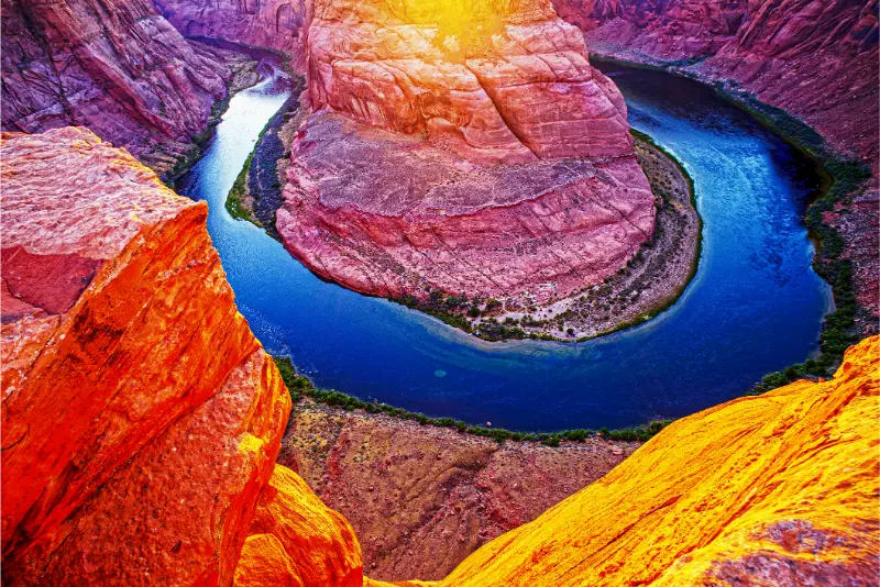
Sunrise is usually my choice for lower temperatures, easier parking and a calmer walk. The river bend can remain partly in shadow, but the experience is less about perfect illumination and more about having space. Sunset produces dramatic color and is understandably popular, so arrive much earlier than the time shown by a weather app.
If you stay for twilight, carry a headlamp. A phone flashlight is not ideal when many people are walking the same sandy path in low light. Remember that no new vehicles are admitted after the parking gate closes at sunset.
Photography tips
A wide-angle lens or phone is useful because the bend is enormous and you stand close to the rim. Avoid backing toward the edge while looking at the screen. Step into a safe position first, then compose. Exposure can be tricky when the canyon floor is dark and the sky is bright; HDR or exposure bracketing can help without making the colors unnatural.
Drones are not allowed from National Park Service lands at Horseshoe Bend. For commercial or specialized photography, check current permits instead of assuming ordinary visitor rules apply.
Visiting with children and older travelers
The main trail is one of the more accessible iconic viewpoints around Page, but exposure is the main concern. Children can become focused on the view or on taking photos and forget how close they are to a drop. Set a clear family rule before reaching the rim: no running, no climbing for photos and no stepping beyond the adults.
For anyone sensitive to heat, start early, take the walk slowly and use the shaded structures along the route when needed. The distance is manageable, but the desert environment can turn a short outing into a difficult one.
Combine Horseshoe Bend with Antelope Canyon
The two attractions fit naturally into one day because Horseshoe Bend does not require a tour reservation. Book Antelope Canyon first, then place Horseshoe Bend before or after it. I prefer sunrise at Horseshoe Bend, breakfast in Page and a later canyon tour because it avoids the worst parking and heat.
If the canyon tour is early, reverse the plan and use late afternoon at the overlook. Do not schedule a sunset visit so tightly that a delayed canyon return forces you to speed or skip food and water.
What not to do
Do not climb onto narrow outcrops for a photograph, fly a drone, leave the trail to search for a private viewpoint or underestimate heat because the car is close. Do not assume the National Park pass makes parking free. Most importantly, do not try to arrive exactly at sunset; traffic and a full lot can erase the entire margin.
The site is memorable without risky behavior. A photograph taken five feet farther from the edge is not meaningfully worse, and the canyon will still look enormous.
Where to stay for this part of northern Arizona
Page is the practical base for most trips around this landscape because it has the largest concentration of hotels, supermarkets, fuel stations, restaurants and tour meeting points. Downtown Page is convenient for early Antelope Canyon departures and evening meals, while the Wahweap side is more attractive when your priority is Lake Powell. Kanab can make sense when a trip is moving toward Zion or Bryce Canyon, but it adds driving for activities centered on Page.
For live rates, cancellation rules and map-based comparison, compare hotels in Page on Booking.com. I would choose the hotel only after confirming the first activity of each morning. A slightly cheaper room is poor value if it creates an hour of extra driving before a fixed tour or an early trail start.
Heat, storms and the desert calendar
This is exposed Colorado Plateau country. In summer, shade is limited and vehicle temperatures rise rapidly; in monsoon season, thunderstorms can create lightning, sudden runoff and dangerous flash-flood conditions in slot canyons and washes. Winter mornings can be below freezing even when afternoons are bright and comfortable. Spring is often beautiful but windy.
The most useful habit is checking the managing agency on the evening before the activity and again in the morning. A reservation does not make weather safe. Carry more drinking water than you expect to use, protect skin and eyes from sun, and keep a warm layer in the car outside midsummer. For canyon hikes, a forecast many miles away is not a substitute for local flood guidance.
Time zones can affect reservations
Arizona generally remains on Mountain Standard Time and does not observe daylight saving time, while the Navajo Nation does observe daylight saving time. Around Page, this can create confusion when a tour, lodging property or road trip crosses jurisdictions. Never guess from the clock on the dashboard if you have a timed check-in.
Use the time printed by the operator or agency and confirm which local time it means when booking. Build a buffer before guided tours rather than planning to arrive at the exact minute. The landscape looks empty on the map, but parking, check-in procedures, road work and slow vehicles can easily consume that buffer.
How this fits into a larger Southwest road trip
Page works naturally between the Grand Canyon, Monument Valley, southern Utah and Flagstaff. It also pairs well with Sedona when the trip has enough nights. I avoid using Page as a base for every famous landmark in the region; the distances are longer than they appear and dawn or sunset driving can be tiring.
Start with the existing Page first-time visitor guide for the broad overview, then use this article for the specific planning details around Horseshoe Bend. A strong itinerary normally has one fixed reservation per day and leaves the rest flexible enough for weather and changing road conditions.
What to pack
My basic kit includes refillable water bottles, salty snacks, sunscreen, a brimmed hat, sunglasses, shoes with reliable grip, a small first-aid kit, offline maps and a charged power bank. For sunrise or sunset, add a headlamp rather than relying on a phone flashlight. For water activities, add a properly fitted life jacket and dry storage for electronics.
Do not treat a short mileage figure as proof that an outing is easy. Sand, heat, exposure, elevation and route-finding can make a modest distance demanding. Families should plan around the slowest walker and carry enough water for delays, not only for the expected duration.
Responsible travel on Navajo, NPS and BLM lands
The Page region crosses Navajo Nation, National Park Service, Bureau of Land Management, municipal and private jurisdictions. Rules can change from one stop to the next. Stay on legal routes, use authorized tour operators where required, obey photography restrictions, never enter closed cultural or archaeological areas and pack out all waste.
Drones are prohibited in National Park Service areas unless specifically authorized. On tribal lands, photography and access rules are set by the land manager and community. Treat these as living cultural landscapes rather than outdoor sets. The best photographs and memories come from visiting respectfully and leaving the place intact.
Practical planning note 1
The best visit is the one that matches your tolerance for heat and crowds. Sunrise prioritizes comfort; sunset prioritizes warm color. Midday can work in cooler months, but summer visitors should treat shade and hydration as essential rather than optional.
Check current agency alerts shortly before travel, keep confirmations and maps available offline, and leave enough daylight to change plans safely. Conditions in canyon country can shift faster than a printed itinerary, so flexibility is part of good preparation rather than a failure to plan.