

Signal Mountain is valuable because it shows you Grand Teton from the opposite perspective of Jenny Lake. Instead of standing at the base of the peaks looking up, the summit looks across Jackson Hole and the Snake River plain toward the Teton Range. A seasonal road makes the viewpoint accessible by car, while a 6.8-mile out-and-back trail provides a forested hiking alternative. Nearby Jackson Lake turns the area into an easy half-day rather than a single viewpoint stop.
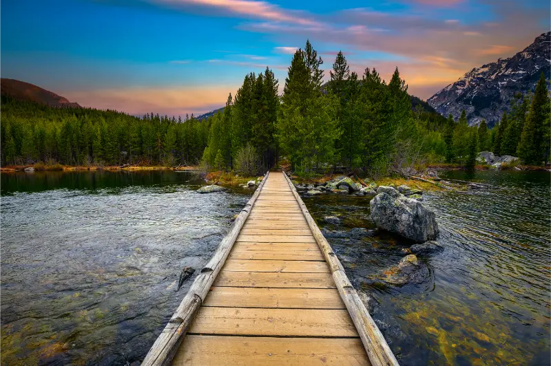
| Elevation | 7,727 feet / 2,355 m |
| Drive | Seasonal Signal Mountain Summit Road |
| Hike | About 6.8 miles / 10.9 km out and back |
| Best use | Panoramic overview and Jackson Lake day |
| 2026 note | Check current road and marina status before arrival |
Why drive to Signal Mountain
The summit road climbs away from Teton Park Road through forest to broad viewpoints. The mountains appear as a long wall across the valley, and the Snake River system becomes easier to understand from above. This is a useful stop early in a trip for orientation or late in the trip when you can identify places already visited.
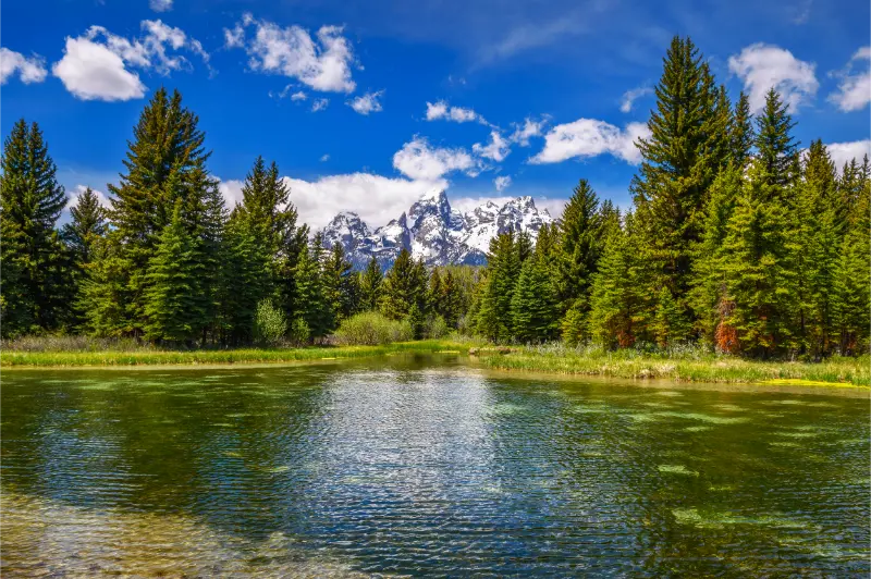
The road is seasonal and conditions can change. Check the official park-road page before setting out, particularly in spring and autumn. If the road is closed, do not assume the hiking trail is an equivalent quick alternative; it is a moderate 6.8-mile round trip that requires much more time and energy.
The summit viewpoints
Two main viewpoint areas give slightly different perspectives. Take time at both instead of driving to the top, photographing once and leaving. Morning light can be clean, while late afternoon can create stronger shadows across the valley. Smoke, haze and clouds may reduce distant visibility, so the viewpoint is not guaranteed to produce a crisp mountain panorama.
Parking is limited and the road is narrow. Large vehicles and nervous mountain-road drivers should check current restrictions and use patience. Do not stop outside designated areas simply because a gap in the trees looks promising.
Hiking Signal Mountain instead of driving
The Signal Mountain Trail begins near the developed area and winds through forest to the summit. At roughly 6.8 miles out and back, it is a genuine half-day hike for many visitors. The reward is not a dramatic alpine basin but the experience of climbing through forest to the same broad summit perspective.
Carry bear spray and make noise in low-visibility vegetation. The trail may be snow-free while nearby high country still holds snow, but that does not eliminate wildlife risk. Check the NPS backcountry and trail-conditions page for current notes.
Jackson Lake: what to add nearby
Signal Mountain sits beside Jackson Lake, making it easy to combine the summit with shoreline time. The lake provides a wide view of Mount Moran and the northern Teton Range. Depending on the season and water levels, marina services, boat ramps and rentals may vary. In September 2026, for example, some Jackson Lake marina and ramp services have been closed or restricted, so verify before planning around a boat launch.
If your priority is simply scenery, you do not need a boat. Picnic areas, lodge viewpoints and shoreline walks provide excellent lake access. Continue north to Colter Bay for the Lakeshore Trail or south toward Jenny Lake for a different scale of mountain-and-water scenery.
Signal Mountain Lodge and services
The lodge area is seasonal and can provide food, fuel and lodging during the main season. These services make Signal Mountain a useful reset point during a park day, but operating dates should be checked for shoulder-season trips. The NPS 2026 schedule shows most Signal Mountain services closing in October.
If you are staying here, the location is excellent for reaching Jenny Lake, Oxbow Bend and Jackson Lake without returning to Jackson each night. The trade-off is fewer evening restaurant and shopping options than downtown Jackson.
Best time of day
I prefer morning for clear air and easier parking, but Signal Mountain is one of the places where afternoon can be just as interesting. As the sun moves west, the Teton faces may become less evenly lit while the valley below gains texture. Sunset from the summit can be beautiful, but driving the narrow road in fading light deserves extra caution.
Wildlife is active around the broader area, especially near dawn and dusk. Slow down on approach roads and remember the park’s night speed limit and wildlife-collision risk.
How Signal Mountain compares with other viewpoints
Mormon Row puts human history in the foreground. Oxbow Bend emphasizes Mount Moran and wetlands. Snake River Overlook uses the river corridor. Signal Mountain is about scale: the elevated perspective shows how those pieces fit together. That is why I would not replace one with another purely because a ranking calls it “better.”
For travelers with limited mobility, the summit road can provide one of the park’s strongest high viewpoints without a major hike when the road is open. For hikers, the trail adds effort but not necessarily a dramatically different final view.
A practical half-day plan
Start with the summit road early, descend for breakfast or a snack near the lodge, then continue to Oxbow Bend and Jackson Lake Lodge. Add Colter Bay if you want an easy shoreline walk. This creates a coherent northern-park loop with minimal backtracking.
If construction causes delays elsewhere in the park, Signal Mountain can be a useful substitute for a crowded Taggart or Jenny Lake morning. Keep it on your backup list rather than treating every day as fixed.
Frequently asked questions
Can I drive to the top of Signal Mountain?
Yes when the seasonal summit road is open. Check current Grand Teton road status before traveling.
How long is the Signal Mountain hike?
The NPS describes the trail as about 6.8 miles / 10.9 km out and back.
Is Signal Mountain good for sunset?
It can be, but the narrow road and wildlife make the drive down after dark slower. Use caution and obey road closures and speed limits.
Can I launch a boat at Signal Mountain in 2026?
Boat-ramp and marina status can change with water levels and construction. Check current NPS conditions before planning a launch.
My practical planning strategy
I use Signal Mountain as the park’s orientation deck. Drive it when the weather is clear enough to see the valley, but do not force the stop if smoke or clouds remove the long view.
Pair it with Jackson Lake rather than treating the summit as an isolated attraction. The combination of elevated panorama and shoreline scenery is what makes this part of Grand Teton feel complete.
Driving the summit road safely
The summit road is narrow, winding and shared by drivers with very different comfort levels. Use pullouts to let faster traffic pass rather than accelerating beyond your comfort. Descend in a low enough gear that you are not riding the brakes continuously, and watch for cyclists where permitted.
Large RVs and trailers should verify current restrictions before attempting the road. If your vehicle is not appropriate, the broader park offers many ground-level viewpoints that do not require a mountain road.
Where Signal Mountain fits on a Yellowstone transfer
If you are moving north toward Yellowstone, Signal Mountain can be a strong final Grand Teton morning because it sits naturally on the route toward Oxbow Bend and Colter Bay. Do the summit first, then continue north. That is more efficient than returning south to Jackson after the viewpoint.

Check North Park Road delays before committing to a tight Yellowstone check-in time. Construction north of Colter Bay has created variable travel times in 2026.
Extra planning notes for Signal Mountain
For Signal Mountain, I keep a simple backup plan that does not depend on perfect weather, empty parking or mobile service. Save the official Grand Teton map offline, note the closest visitor center, carry enough water and food for an unexpected delay, and check the current-conditions page before leaving your lodging. In 2026 this matters more than usual because construction can change access even when the destination itself remains open.
I also separate driving time from sightseeing time. A route that appears to take twenty minutes can take much longer when bison cross the road, a ranger manages a wildlife jam or construction reduces traffic to one lane. Avoid putting a nonrefundable activity immediately after a scenic drive, and keep at least one low-commitment alternative nearby.
Finally, use durable surfaces and designated pullouts. Grand Teton’s open valley can make it feel as if there is room to park or walk almost anywhere, but roadside vegetation, wildlife habitat and historic resources are easily damaged. The legal turnout or marked trail is part of the experience, not an obstacle to it.
For Signal Mountain, build in one more margin that many itineraries omit: time to stop without pressure. Weather can change the appearance of the mountains in minutes, wildlife may hold traffic, and a legal parking area may be full. A schedule with no spare time encourages poor decisions. I would rather remove one minor stop and have enough flexibility to wait safely, eat properly and return before dark. That small buffer is especially useful in 2026 while road and trail projects continue around the park.