

The best Mount Rainier hike is not always the most famous one; it is the best open trail for your weather, road access, fitness and season. In 2026 that distinction matters because wildfire closures affect the Sunrise and northern backcountry, Ohanapecosh is under construction, and the Fairfax Bridge closure blocks normal public access to Carbon River and Mowich from SR 165.
This guide focuses on hikes that make sense for current visitors while explaining which classic routes require extra condition checks. Always use the NPS day-hiking guide, current Mount Rainier alerts and conditions and trail-condition page before leaving your lodging.
| Easy family option | Nisqually Vista, Paradise |
|---|---|
| Short history/forest walk | Trail of the Shadows, Longmire |
| Classic strenuous day hike | Skyline Trail, Paradise |
| Waterfall hike | Comet Falls or Silver Falls, access permitting |
| Current 2026 caution | Sunrise/Grand Park fire closures and Mowich access closure |
1. Skyline Trail: the classic all-around hike
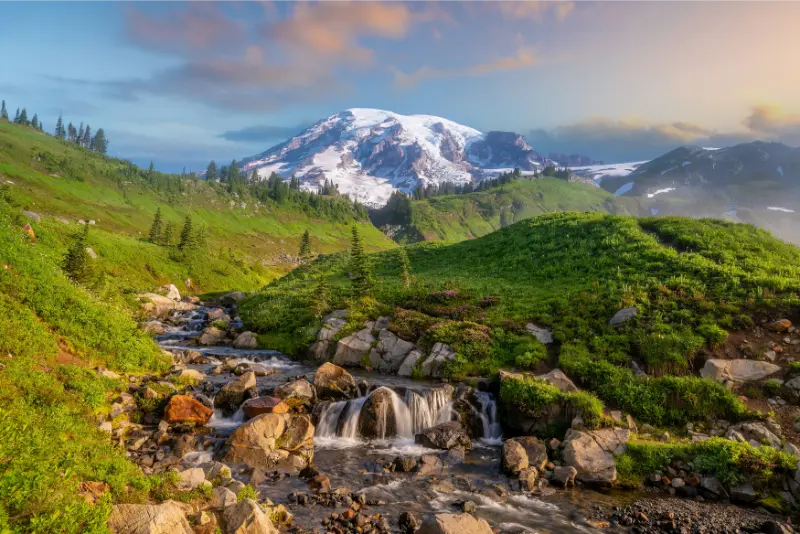
Skyline is the best single trail for many fit first-time visitors because it combines subalpine meadow, glacier views and broad panoramas. The full loop is 5.5 miles with about 1,700 feet of elevation gain. It is popular, exposed and often snowy earlier than lowland hikers expect.
Use our Skyline Trail guide for route strategy, the High Skyline section and snow considerations. If the forecast is poor or your group is tired, shorten the day rather than forcing the complete loop.
2. Nisqually Vista: best easy mountain-view loop
Nisqually Vista is a 1.2-mile loop from the lower Paradise parking area. NPS describes it as suitable for families with strollers, although snow or weather can change surface conditions. It works especially well for mixed-ability groups because you can experience meadow scenery and glacier views without committing to a major climb.
3. Myrtle Falls: short, iconic Paradise walk
The lower Skyline route to Myrtle Falls is one of the park’s most photographed short walks. Its convenience is also its weakness: it can be crowded. Go early or later, stay on trail and do not block narrow sections for a long photo session. In peak wildflower season, the meadow itself is as important as the waterfall.
4. Trail of the Shadows: best easy forest and history loop
At Longmire, Trail of the Shadows loops about 0.7 mile around a meadow formed by mineral springs. The route mixes forest, early park history and wildlife habitat. It is a smart choice when clouds hide the mountain or when high-elevation trails are snowy.
The road-side half of the loop is flatter and more accessible than the rougher far side. Longmire is open year-round, though snow and ice can still affect winter footing.
5. Rampart Ridge: best moderate Longmire climb
Rampart Ridge gives stronger hikers a more substantial Longmire option. NPS lists the loop at about 4.6 miles. The climb is steep enough to feel like a real workout, but the lower-elevation forest setting can be useful when Paradise is clouded in or parking is difficult.
6. Comet Falls and Van Trump Park
Comet Falls is one of the park’s standout waterfall objectives. The route is steep and can be slippery around water. Strong hikers can continue farther toward Van Trump Park when conditions allow, turning a waterfall hike into a larger alpine day. Parking at the small trailhead is a major constraint, so have a backup rather than waiting on the road.
7. Bench and Snow Lakes
This 2.5-mile round trip east of Reflection Lakes crosses rolling terrain to two lakes. In summer, bear grass and meadow flowers can be excellent. The hike pairs naturally with a Paradise-Stevens Canyon day and is often less psychologically intimidating than Skyline while still offering a genuine trail experience.
8. Pinnacle Peak
Pinnacle Peak starts near Reflection Lakes and climbs into the Tatoosh Range. NPS lists it at roughly 2.5 miles round trip. The route is short but steep, with rocky terrain and exposure near the upper sections. It is best for hikers who are comfortable with elevation gain and changing mountain weather.
9. Silver Falls from the southeast side
Silver Falls remains an important southeast-side option during the Ohanapecosh construction year. NPS states that the trail can be accessed from the Grove of the Patriarchs trailhead, even though the grove itself is closed. Follow signs carefully and do not cross closure barriers.
10. Carbon River forest trails: access problem in 2026
Carbon River has excellent low-elevation rainforest hiking, but the Fairfax Bridge closure on SR 165 means there is no normal public access from that route for vehicles, pedestrians or bicycles. This is a perfect example of why a trail list without access context can mislead travelers. Save Tolmie Peak and Mowich-based hikes for a trip when legal access is restored, unless you are reaching them as part of a permitted long-distance backcountry route.
What about Mount Fremont and Burroughs Mountain?
These are classic Sunrise-area hikes in a normal season. In late September 2026, however, Sunrise Road is closed to vehicles and fire closures affect Grand Park and portions of the northern trail network. Do not build a trip around a Sunrise classic without confirming that the road and exact trail are officially open.
How to choose by season
Early summer favors lower trails unless you have snow skills. Mid-to-late summer normally offers the broadest selection and best wildflower potential. September brings cooler temperatures, huckleberry color and shorter days. Winter concentrates recreation around Longmire and Paradise, with snowshoeing and winter travel skills replacing dry-trail hiking.
How to choose by weather
On a clear stable day, prioritize high-elevation routes. In low clouds, forest hikes and waterfalls can be more rewarding. In thunderstorms or strong wind, exposed ridges are poor choices. Heavy rain raises slip and river hazards. Good hiking at Mount Rainier begins with selecting terrain that fits the weather rather than selecting a trail weeks in advance and refusing to change.
Parking is part of the hike
Several popular trailheads have tiny lots. Never invent a parking space that blocks traffic or vegetation. If a lot is full, move to your second choice. A flexible list of three hikes in the same corridor is more useful than a single must-do route.
Final advice
Mount Rainier rewards adaptable hikers. Pick one ambitious trail and one easier backup for each day. Check road and fire closures, carry the ten essentials and turn around when snow, smoke, weather or fatigue changes the equation. The park has enough variety that changing trails is not losing the day; it is often the smartest way to experience it.
Related Mount Rainier guides
How to build a hiking portfolio for your trip
For a three-day stay, choose one hard hike, one moderate hike and one easy weather-proof walk instead of three strenuous objectives. This gives your legs time to recover and protects the trip if one corridor closes.
Keep hikes within the same road corridor on the same day. Driving from Paradise to a distant trailhead for a second major hike usually costs more time and energy than the map suggests. Add a short waterfall or viewpoint near your first trail instead.
If you are coming from sea level, the combination of elevation and steep grades can surprise you. Start the first day with a moderate route before committing to the longest climb. Altitude at Mount Rainier is not extreme at trailheads, but exertion above 5,000 feet can still feel different.
Trail popularity is not a safety rating. A busy route can still have snow, exposure and river hazards. Evaluate the actual terrain and your group rather than assuming a famous trail is beginner-friendly.
Practical checklist before you go
- Check the official NPS alerts, road status and weather on the morning of your visit.
- Download maps before entering areas with weak mobile coverage and carry the ten essentials for hikes.
- Start popular trailheads early, park only in legal spaces and keep a backup activity in the same road corridor.
- Carry water, food, sun protection and a warm waterproof layer even when the lowland forecast looks mild.
- Respect wildlife distance, stay on established trails and follow every fire, construction and emergency closure.
Mount Rainier changes quickly because elevation, snow, wildfire, construction and weather affect different sides of the mountain in different ways. A plan that works on one date may need adjustment the next day. Treat current official information as part of the itinerary, not as a final check after every other decision is fixed.
Build at least thirty to sixty minutes of unscheduled time into a mountain day. Entrance traffic, a wildlife sighting, a short road control or a full parking lot can all change the schedule. That buffer also gives you room to stop safely for a viewpoint instead of making rushed decisions because the itinerary is already late.
Tell someone outside your group where you plan to hike and when you expect to return, especially on longer trails. Mobile coverage is unreliable in several parts of the park. A downloaded map is useful, but it does not replace route awareness, weather judgment or the ability to turn around before conditions become unsafe.
Finally, match the objective to the least experienced person in the group. Mount Rainier rewards conservative decisions because the same trail can shift from dry summer walking to snow, fog, wind or heavy rain in a short period. Finishing a shorter route comfortably is better than forcing a famous itinerary because it appeared on a must-do list.
Before leaving the trailhead, make one final equipment check: water, food, insulation, rain protection, navigation and a charged phone or emergency device. Small omissions become larger problems once the group is several miles from the car, especially when temperatures fall or a route takes longer than expected.
When you return, check the next day’s official status again rather than assuming conditions are unchanged. Fire boundaries, construction controls, campground availability and mountain weather can all move quickly. This habit is especially important on multi-day trips that switch between Paradise, Longmire, White River and the southeast side.