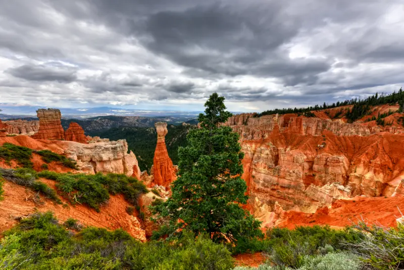

Two days is an excellent amount of time for Bryce Canyon because the park is compact enough to understand quickly but varied enough that one rushed afternoon misses its best contrast: looking down into the hoodoos and then walking among them. I would use the first day for the Bryce Amphitheater and the Queen’s Garden/Navajo combination, then reserve the second for the 18-mile park road, quieter viewpoints and a flexible evening for sunset or stars. In 2026 you do not need a reservation to enter the park, and the free shuttle makes the busy amphitheater much easier to manage during its operating season.
| Ideal stay | 2 full days |
| Entry reservation | Not required in 2026 |
| 2026 shuttle season | April 3 to October 18 |
| Best first hike | Queen’s Garden + Navajo Loop |
| Second-day focus | Southern Scenic Drive and quieter viewpoints |
Day 1 morning: start with the amphitheater, not the scenic drive
If you are visiting during shuttle season, park at the Bryce Canyon City Shuttle Station or the additional lot near the Visitor Center and let the bus handle the short, congested amphitheater corridor. The 2026 Bryce Canyon shuttle runs from April 3 through October 18, with later evening service during the main summer season. The shuttle is included with park admission and typically arrives at stops about every 15 minutes. It is not mandatory, but it removes the need to circle small lots at Sunrise and Sunset Points.
Begin at Sunrise Point and walk the Rim Trail toward Sunset Point before descending. That short rim segment gives a useful overview of the amphitheater and makes the geology easier to read once you are below. The hoodoos are not a single wall; they are eroded fins, windows and spires arranged in layers, and the angle from the rim lets you see how the trail threads between them.
Day 1 main hike: Queen’s Garden and Navajo Loop
The classic first-time route is the 2.9-mile Queen’s Garden/Navajo combination. NPS recommends descending Queen’s Garden from Sunrise Point and ascending Navajo from Sunset Point. Queen’s Garden is the least difficult trail that descends from the rim, while Navajo is steeper and more enclosed. Together they create a route that changes character several times instead of repeating the same scenery.
In winter the Wall Street side of Navajo Loop closes, so use the Two Bridges side or follow current NPS routing. Even in summer, do not assume every branch is open after storms or rockfall. Our dedicated Queen’s Garden and Navajo Loop guide explains the trail junctions, direction choice and seasonal variations in more detail.
Day 1 afternoon: Inspiration Point and Bryce Point
After lunch, use the shuttle or drive to Inspiration Point and Bryce Point. These are not redundant with Sunrise and Sunset Points. Inspiration Point gives a broad, elevated look across the dense hoodoo field, while Bryce Point feels more expansive and helps you understand the plateau edge. If midday light is harsh, focus on the overall patterns rather than trying to recreate a sunrise photograph.
Keep the afternoon intentionally light after the below-rim hike. High elevation makes even moderate mileage feel more tiring, especially for travelers arriving from Las Vegas or lower desert parks. A visitor-center stop, short rim walk and early dinner often produce a better evening than adding another steep trail simply because the map looks compact.
Day 1 evening: sunset or stars
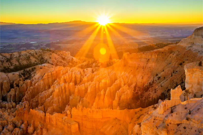
Sunset Point is famous, but its name does not mean it is the only place worth visiting at sunset. Paria View can receive direct late light on formations that face west, while Inspiration Point and Bryce Point provide wide compositions. Choose one place and arrive early enough to park legally rather than racing between overlooks as the light changes.
If the sky is clear, Bryce is also an International Dark Sky Park. A moonless night can reveal the Milky Way and a remarkable number of stars. Check the ranger-program calendar because telescope programs and special astronomy events vary by date. In 2026 the park’s Astronomy Festival ran June 11–13, a useful reminder that night-sky programming is a major part of the Bryce experience.
Day 2 morning: drive south before stopping
The main park road runs 18 miles from the entrance to Rainbow and Yovimpa Points. NPS recommends driving to the end first and visiting the southern overlooks on the return north because the viewpoints then fall on the right side of the road. This simple strategy reduces left turns across traffic and keeps the day flowing.
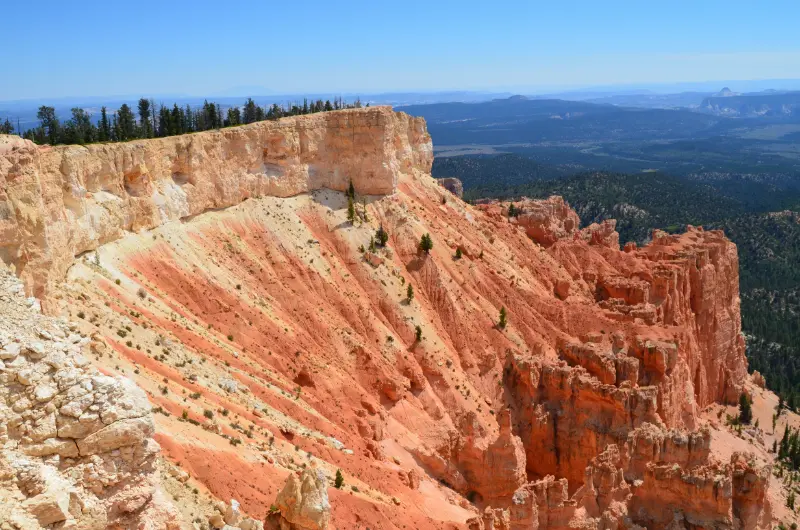
Rainbow and Yovimpa Points sit above 9,000 feet, noticeably higher than the Visitor Center. The scenery here is broader and more forested than the main amphitheater. If conditions are good, add the Bristlecone Loop or another short walk rather than treating the road as a sequence of five-minute photo stops.
Day 2 return: Natural Bridge, Agua Canyon and Farview
On the drive north, stop at Natural Bridge, Agua Canyon, Ponderosa Canyon, Farview and any other signed viewpoints that appeal to you. Natural Bridge is actually a natural arch or window rather than a true bridge, created by erosion and freeze-thaw processes. Farview can reveal extremely long sightlines toward distant plateaus when the air is clear.
Do not feel obligated to stop at every overlook. The road becomes more memorable when you choose three or four places and spend time looking rather than repeatedly getting in and out of the car. Our Bryce Canyon Scenic Drive guide offers a stop-by-stop strategy.
Day 2 afternoon: Fairyland, Mossy Cave or a slower finish
If your legs are fresh, Fairyland Loop is an eight-mile strenuous hike with long views and fewer crowds than the central amphitheater trails. If you want something much shorter, Mossy Cave lies off Highway 12 north-east of the main entrance. Remember that its parking area can fill and roadside parking is not a safe substitute.
Another strong option is to return to the rim and simply walk between viewpoints. Bryce is unusually good for travelers who want dramatic scenery without a long hike. The best second afternoon depends on energy, weather and whether you already have a long drive to your next destination.
How this fits into a Utah road trip
Bryce is often placed between Zion and Capitol Reef, and that sequence works well because the landscapes change dramatically without requiring enormous transfer days. Do not plan a strenuous Zion hike, drive to Bryce and then expect to hike Queen’s Garden the same afternoon unless your group is accustomed to high-output travel.
If you have only one night, prioritize the amphitheater and one below-rim hike. If you have three nights, add Fairyland Loop, a ranger program or a slower scenic-drive morning. More time does not need to mean more mileage; it can mean seeing the same hoodoos in different weather and light.
Frequently asked questions
Do I need a reservation to enter Bryce Canyon in 2026?
No. Bryce Canyon does not require a general vehicle reservation or timed-entry reservation in 2026.
Is two days too much for Bryce Canyon?
No. One day can cover the highlights, but two days lets you hike below the rim, drive the southern road and enjoy sunrise, sunset or stargazing without rushing.
Can I do Bryce Canyon without the shuttle?
Yes. Private vehicles are allowed, but the shuttle is often easier for the congested amphitheater area during its operating season.
What if Wall Street is closed?
Use the Two Bridges side of Navajo Loop and follow current NPS trail guidance. Wall Street closes seasonally in winter and can also be affected by conditions.
My practical planning strategy
I would protect the first morning for the Queen’s Garden/Navajo hike and keep the rest flexible. If clouds, snow or fatigue change the day, the viewpoints still deliver a strong experience.
On the second day, drive to Rainbow Point first, work back north, and stop when a viewpoint genuinely adds something. That rhythm gives Bryce enough space to feel like a national park rather than a scenic layover.
Practical details that matter for a two-day Bryce Canyon trip
Bryce Canyon sits at high elevation, so I plan a two-day Bryce Canyon trip around temperature, sun exposure and the possibility of fast weather changes rather than around mileage alone. Summer afternoons can feel warm in direct sun while mornings and evenings are chilly; spring and fall can bring snow or ice with little warning. The itinerary is built to leave room for these changes rather than forcing a rigid hour-by-hour schedule. I keep a warm layer, rain shell, water and sun protection in the day pack even when the forecast looks uncomplicated. The rim is exposed, and a short walk at more than 8,000 feet can feel more demanding than the same distance at sea level.
Parking is another part of the plan, not an afterthought. During the 2026 shuttle season, the easiest strategy for the amphitheater is often to park at the Shuttle Station in Bryce Canyon City or the additional lot near the Visitor Center, then use the free park shuttle. Buses generally arrive about every 15 minutes. The shuttle does not serve every southern scenic-drive viewpoint, so I separate an amphitheater day from the longer drive to Rainbow and Yovimpa Points instead of trying to use one transportation method for everything.
I also save the NPS map and key pages offline before arrival. Cell service can be inconsistent, and it is frustrating to discover that your trail notes, hotel address or shuttle schedule exist only in a browser tab that will not load. A screenshot of the trail map, your lodging confirmation and the current-conditions page is enough for most day trips. If snow or a closure changes a route, ask at the Visitor Center rather than improvising on an unmaintained slope.
Food and water need simple planning because the park is compact but services are concentrated. I fill bottles before leaving the developed area and carry enough snacks to turn a delayed lunch into a minor inconvenience instead of a reason to rush. For a longer day, eating before the busiest restaurant hours can save surprising amounts of time. Bryce Canyon City has the most convenient gateway services, while Tropic is a useful alternative for lodging and meals east of the park.
Finally, I treat sunrise, sunset and night-sky plans as separate activities from a full hiking day. Driving when tired on dark plateau roads is not worth squeezing in one more viewpoint. Wildlife can be active near roads after dark, and temperatures fall quickly. If I am staying for stars, I leave a warm layer, headlamp with a red-light mode and a thermos in the vehicle, and I choose a legal parking area before it becomes fully dark.
For a wider southern Utah trip, Bryce fits naturally between Zion National Park and Capitol Reef. Travelers continuing toward Kanab can also use our Grand Staircase-Escalante and Kanab guide. I would still give Bryce at least one full day rather than treating it as a roadside photo stop: the scale of the hoodoos becomes much clearer once you descend below the rim.