

Kolob Canyons is still Zion National Park, but it feels like a separate destination because it sits about an hour from Zion Canyon with its own Interstate 15 entrance. That separation is exactly why I like it. The district has soaring red walls, a compact scenic drive and trailheads that let you experience Zion without repeating the shuttle corridor. It works especially well on a transfer day toward Cedar City or Las Vegas.
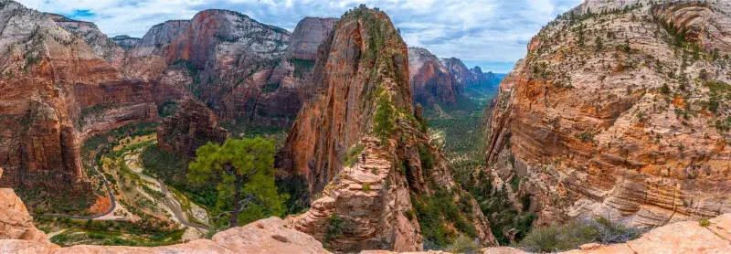
NPS describes Kolob Canyons as the park’s northwest corner, reached from Exit 40 on I-15. A roughly five-mile scenic road climbs past viewpoints and trailheads, and the area includes more than 20 miles of hiking. Check the official Kolob Canyons page before leaving because winter snow or ice can close the road.
| Access | Exit 40 on Interstate 15 |
| Distance from Zion Canyon | Roughly 40 road miles / about an hour |
| Scenic road | About 5 miles one way |
| Easy hike | Timber Creek Overlook Trail |
| Longer day hike | Taylor Creek Trail |
Why Kolob deserves more than a quick detour
The visual language is unmistakably Zion—Navajo sandstone, deep side canyons and massive cliff faces—but the layout is different. Instead of a long central canyon served by buses, Kolob is a drive-up district with several trailheads and overlooks along a rising road. That makes it easier to explore independently and easier to combine with travel along I-15.
The mistake is assuming “quieter” means empty. Parking at popular trailheads is still limited, and holiday weekends can fill spaces. Arrive early if Taylor Creek is your priority, and keep Timber Creek Overlook as a lower-commitment alternative.
The five-mile scenic drive
The Kolob Canyons Road climbs quickly from the visitor center into a landscape of parallel finger canyons. Even if you do not hike, the drive is worth the entrance because the viewpoints reveal cliff systems you cannot see from Springdale. Use signed pullouts and keep the travel lane clear; stopping wherever the light looks good damages roadside vegetation and creates safety problems.
Allow at least 60–90 minutes for an out-and-back drive with short stops. If you add a hike, budget half a day. The road may close temporarily for snow or ice in winter, so check current conditions rather than assuming desert means snow-free.
Timber Creek Overlook Trail
Timber Creek Overlook is the easiest way to add a walk. The trail is about a mile round trip with modest elevation change and opens to views across Timber Creek, Kolob Terrace and toward the Pine Valley Mountains. It is a good choice for families, photographers and anyone arriving too late for Taylor Creek.
The ridge can be windy and exposed. Bring water, sun protection and a layer outside midsummer. The short mileage does not justify sandals on loose rock, especially after rain or during freeze-thaw conditions.
Taylor Creek Trail
Taylor Creek is the more immersive day hike. It follows the Middle Fork of Taylor Creek into a canyon, crossing the stream multiple times and passing historic cabins before reaching Double Arch Alcove. The route feels very different from the paved climbs in Zion Canyon, with more shade and a stronger backcountry character.
Water levels and mud vary by season. Stream crossings can be straightforward in low water and awkward after storms or snowmelt. Carry enough water rather than assuming the creek is a drinking source, and check current trail conditions before committing to the full out-and-back.
La Verkin Creek and wilderness travel
Longer routes into La Verkin Creek and Kolob Arch move beyond casual sightseeing into wilderness planning. Overnight travel requires a wilderness permit, and distances, water availability and route finding matter. Kolob Arch itself is impressive, but it is not a roadside attraction hidden just beyond a short trail.
If backpacking is your goal, use current NPS wilderness information and build the trip around seasonal water and campsite rules. This guide is aimed primarily at day visitors; do not extend a day-hike plan into an overnight trip without the appropriate permit and equipment.
Best seasons
Spring and fall are my favorite windows because temperatures are generally easier for hiking than midsummer. Wildflowers, changing vegetation and low-angle light can make the drive especially beautiful. Spring can also bring wet crossings and muddy trails, while fall days become shorter quickly.
Summer is workable with early starts and plenty of water. Winter can be striking after snow, but road closures, ice and short daylight require more flexibility. The visitor center may also have seasonal hours that differ from the main Zion Canyon visitor center.
How Kolob fits into a Zion itinerary
Our three-day Zion itinerary uses Kolob as a third-day option after the main canyon and east side. It is also excellent on the day you drive between Zion and Las Vegas because the I-15 entrance avoids a long detour back through Springdale.
If you are headed north toward Cedar City or Salt Lake City, Kolob can be the final Zion experience before continuing. Do not pair a full Taylor Creek hike with Angels Landing or The Narrows on the same day; the road transfer and physical effort make that plan less efficient than it looks on a map.

Where to stay nearby
Springdale remains best for a trip dominated by Zion Canyon. Cedar City is convenient if Kolob is part of a northbound itinerary, while La Verkin and Hurricane can offer lower-cost rooms between I-15 and Springdale. Our where-to-stay guide compares these bases.
If you want to compare current rates, search Springdale lodging on Booking.com and then compare Cedar City for the transfer night. The cheapest room is not always the best choice if it adds an hour of backtracking.
Practical visitor-center and fee details
All visitors entering at Kolob should be prepared to show an accepted interagency pass or pay the Zion entrance fee. The same park pass covers the main Zion Canyon entrance and Kolob during its validity period; Kolob is not a separately ticketed attraction.
Wilderness permits are handled through Zion’s wilderness system rather than simply obtained because you reached the Kolob visitor center. If your plan includes backcountry camping, confirm the current permit pickup and reservation instructions before travel.
What I would bring to Kolob Canyons
- A full water supply even for a short scenic-drive visit.
- Trail shoes for loose sandstone and possible stream crossings.
- Downloaded trail maps because service can be inconsistent.
- A layer for wind and temperature changes at higher viewpoints.
- A backup hike in case your first trailhead parking area is full.
Frequently asked questions
Is Kolob Canyons part of Zion National Park?
Yes. It is the northwest district of Zion National Park, but it has a separate road entrance from Interstate 15 rather than from Springdale.
Does the Zion Canyon shuttle go to Kolob Canyons?
No. Kolob is not served by the Zion Canyon shuttle. You need a vehicle or another arranged road transfer to reach the district.
How long should I spend there?
Allow at least 60–90 minutes for the scenic drive and viewpoints. Add two to five hours if you plan a hike such as Timber Creek Overlook or Taylor Creek.
Can the Kolob road close?
Yes. NPS notes that the road can close in winter because of snow or ice, and temporary closures can happen for other safety or maintenance reasons. Check current conditions.
My practical planning strategy
Use Kolob Canyons when you want Zion scenery without repeating the same main-canyon logistics. It is especially efficient on an I-15 travel day and gives a first trip a better sense of the park’s scale.
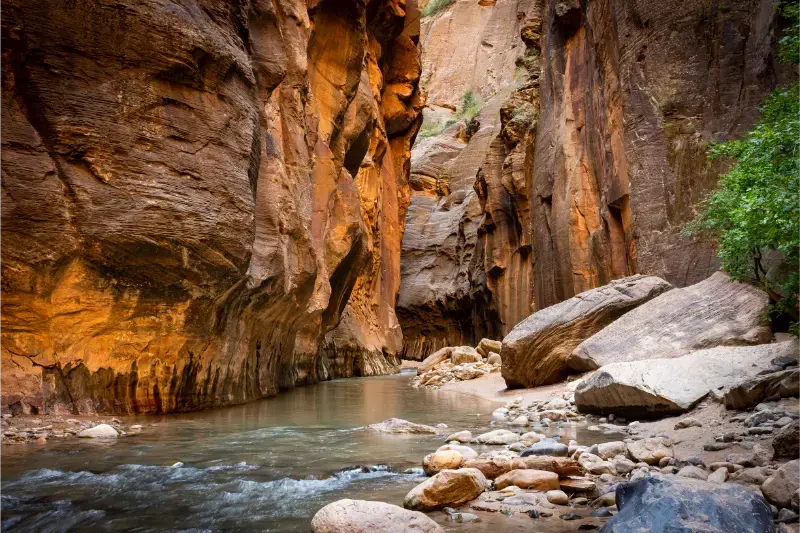
I would choose one hike, drive the scenic road slowly and leave room for unscheduled overlooks. Kolob’s value is the change of pace; turning it into another rushed checklist defeats the reason to go.
A few details that are easy to overlook
Zion rewards conservative time estimates. Distances on a map are short, but a day can include walking from a hotel, waiting for a town shuttle, entering the park, queuing for the canyon bus, riding to a trailhead and then repeating the process in reverse. I budget those transitions explicitly rather than calling them “extra time.” This is especially important on hot days, when ten minutes standing in direct sun can feel more tiring than ten minutes on a shaded trail.
Mobile coverage is inconsistent inside the canyon and on the park’s plateaus. Save maps, permit confirmations, hotel details and transportation schedules offline. Tell someone your planned route if you are hiking away from the busiest corridor. A small battery pack is useful because navigation, photography and digital permits can drain a phone quickly, but electronics should never replace a paper or downloaded map and a realistic turnaround time.
Finally, separate “open” from “appropriate.” A trail can be legally open while heat, wind, mud, river flow or your group’s condition makes another choice better. Zion has enough alternatives that changing plans is rarely a loss. The strongest itineraries use current conditions to decide which experience belongs on which day instead of forcing an activity because it appeared in the original schedule.
I also keep the next meal and the return journey in the plan. Long hikes feel very different when a group has eaten only a snack, and the final shuttle, hotel check-in, rental return or evening drive can create pressure at exactly the wrong time. Carry enough food to make an unexpected delay comfortable, and avoid scheduling a long highway transfer immediately after a strenuous trail unless someone else is rested and ready to drive.
For photography, wildlife and viewpoints, use established pullouts and trail surfaces. Zion’s roadside shoulders and cryptobiotic soils are not overflow parking, and stepping off route for a slightly different camera angle can damage fragile ground. A slower, legal approach usually produces a better visit than trying to reproduce a social-media image from an unsafe or closed location.