

Staircase is Olympic National Park’s southeastern gateway and one of the best choices for travelers approaching from Olympia, Tacoma or the Hood Canal side. It offers giant Douglas-firs, the North Fork Skokomish River, a compact developed area and easy access to short forest walks. In 2026, however, Staircase requires extra context because the developed area reopened after a year-long closure related to the 2025 Bear Gulch Fire, while some backcountry routes remain affected.
The important 2026 reopening update
NPS announced that the Staircase developed area reopened on July 8, 2026 after being closed since the human-caused Bear Gulch Fire began in Olympic National Forest in July 2025. According to the July 2026 NPS reopening notice, visitors again have access to the campground, ranger station, Rapids Loop Trail and developed facilities.
The reopening does not mean every wilderness trail is automatically restored. Fire damage, hazard trees, bridge problems and damaged backcountry infrastructure require separate assessments. Check the latest trail and fire pages immediately before choosing a longer route.
Getting to Staircase
NPS Staircase information places the area in the southeastern corner of the park, roughly an hour from Olympia under normal conditions. The final access road includes unpaved sections and can close for snow, storms or maintenance. The route passes the Lake Cushman area before reaching the park.
Staircase is not connected by road through the mountains to Hurricane Ridge or the Hoh. For a peninsula loop, it usually works as the first or final Olympic stop rather than a midday detour from Forks or Port Angeles.
Staircase Rapids Loop
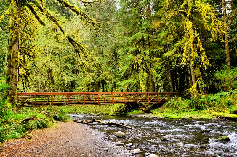
The Rapids Loop is the most useful short hike for first-time visitors because it delivers old-growth forest and river scenery without committing a full day. It works especially well for families and for travelers who arrive after the long drive from Seattle or Portland.
After the 2025 fire and 2026 reopening, follow current signs rather than relying on an old GPS track. Fire-recovery areas can change quickly as crews remove hazards and repair structures. Staying on open trails protects both visitors and recovering terrain.
Shady Lane and Lake Cushman side trips
Shady Lane provides another relatively gentle forest option, and Lake Cushman outside the park adds water access and a change of scenery. Be clear about boundaries: some recreation sites around Lake Cushman are not managed by Olympic National Park, so parking, fees and rules can differ.
If your goal is a relaxed day, combine one Staircase trail with a legal Lake Cushman picnic or shoreline stop. That is usually more enjoyable than adding a long mountain hike simply because the map shows several trailheads nearby.
Longer trails and current limitations
Historically, Staircase has served as a gateway to the North Fork Skokomish corridor, Flapjack Lakes and deeper Olympic Wilderness. In 2026, fire recovery means you must verify exactly which routes are open before setting out. A trailhead sign or ranger update on the day of your visit is more authoritative than any itinerary published months earlier.
If a backcountry route is closed, do not treat the closure as an invitation to improvise around it. Burned areas can contain unstable trees, damaged bridges and hidden holes where roots burned underground. Choose another open trail and return in a later season.
Camping at Staircase
The 2026 Olympic camping page lists Staircase Campground as a seasonal campground. Following the July reopening, reservations were restored for the main 2026 summer period. Facilities and reservation rules can shift with the recovery work, so confirm current status before driving the long spur road expecting an overnight site.
For comparison with Kalaloch, Mora, Hoh, Fairholme and the other park campgrounds, see the Olympic National Park camping guide.
Staircase with children
Staircase is one of the better Olympic areas for young families when the developed area is open. The river, giant trees and relatively short walks give children strong visual rewards without long car transfers between stops. Keep children away from fast current and unstable banks, especially after rain or snowmelt.
Fire-recovery messaging can also become part of the visit. Explain why some areas are closed and how forests change after disturbance. That helps turn restrictions into a meaningful conservation lesson rather than simply an inconvenience.
Road and vehicle considerations
The last part of the Staircase approach is not a fast highway. Gravel, potholes and seasonal damage can make travel slower than the distance suggests. Standard passenger cars commonly use the route when it is open, but drive conservatively and do not take a long RV or trailer beyond what current park guidance recommends.
Fill fuel and bring food before leaving the main Highway 101/Hoodsport corridor. Staircase is close enough to civilization for a day trip but remote enough that forgetting basics becomes annoying.
When Staircase fits best in an Olympic itinerary
Use Staircase if you are entering or leaving the peninsula on the southeastern side, staying around Hood Canal, or want a forest destination that avoids the Hoh’s peak-summer queue. It is less efficient if you are already based in Forks and have only one day left.
The Olympic first-time guide explains the park’s separate road corridors. Thinking in geographic zones prevents the common mistake of assuming all named park attractions sit close together.
A practical half-day itinerary
- Check the Staircase road, fire and trail status before leaving Hoodsport or Olympia.
- Drive slowly on the final approach and park only in the developed area.
- Walk the Rapids Loop while daylight and energy are good.
- Eat lunch at an appropriate picnic area and speak with a ranger if longer trails interest you.
- Add a second short open trail or a Lake Cushman stop.
- Leave enough time for the gravel-road return before dark if conditions are wet or visibility is poor.
A half day is enough to understand Staircase. A full day makes sense only if current conditions support a longer open hike.
What to bring in 2026
- Downloaded NPS road and trail status.
- Waterproof jacket and extra layer.
- Food and water for the full visit.
- Shoes suitable for wet roots and gravel.
- Emergency supplies appropriate for a remote road.
- A backup destination in case fire, storm or repair work closes the area.
The final item matters more than it sounds. Olympic conditions change quickly, and a flexible traveler usually has a better day than someone committed to one trail regardless of official closures.
Respecting a recovering landscape
Fire is part of Pacific Northwest ecology, but a recent human-caused fire also creates years of repair work. Do not enter closure zones, move barriers or collect burned material. Give crews room to work and stay alert for changing signage.
Photograph recovery from open trails and viewpoints. Returning in future years can be rewarding because you can watch vegetation, wildlife use and infrastructure gradually change.
How to avoid the most common planning mistake
The most common mistake in Olympic is treating drive time as empty space between attractions. Roads are part of the trip: they are narrow in places, wildlife may be present, construction can slow traffic and scenic pullouts invite stops. Build margin into every transfer. If a map says a drive should take an hour, do not schedule the next activity exactly sixty minutes later. A realistic buffer protects reservations, keeps the driver rested and gives you permission to stop when the landscape is worth it.
Mobile service and offline planning
Cellular coverage is inconsistent across the peninsula. Download the park map, hotel address, reservation confirmations and any tide or trail information while you still have service. A paper map is also useful because it makes the road layout obvious when a navigation app tries to route you through a closed or unsuitable road. Tell someone your plan before longer hikes, and never rely on a phone signal as the only emergency strategy.
Leave No Trace in a busy national park
Olympic receives heavy use in concentrated corridors, so small choices matter. Stay on durable surfaces, pack out every piece of trash, keep wildlife wild, leave plants and cultural objects where you find them and follow food-storage rules. At beaches, avoid trampling tide-pool organisms and give resting wildlife space. In alpine areas, remain on established trails where possible because short growing seasons make meadow damage slow to heal.
Photography without slowing everyone else down
Popular viewpoints often have limited space. Take photographs from established overlooks, then move aside so other visitors can enjoy the view. Do not block boardwalks, bridges or trail bottlenecks for a long photo session. A small telephoto lens is more useful for wildlife than approaching an animal, while a microfiber cloth is valuable in rain forest and coastal spray. Protecting the experience of other visitors is part of good trail etiquette.
Food and water strategy
Carry enough water for the day’s active portion and keep a backup bottle in the vehicle. Olympic’s cool climate can hide dehydration because you may not feel as thirsty as in a desert park. Pack lunch when heading down long spur roads; services at trailheads are limited and seasonal. Eat before you become exhausted, and secure all food from wildlife whenever you leave the vehicle or campsite.